Alas, poor Winterpeg. Sitting there year after year waiting for a bit of lovely climate emergency to make the winters a bit less harsh. But in a data set that goes back to 1938, the warmest average daytime high was recorded way back in 1949 while the year with the highest average daytime mid-range was even further back in 1938. The coldest? 2009. It's not your imagination: that city still gets cold.
The temperature chart tells the story:
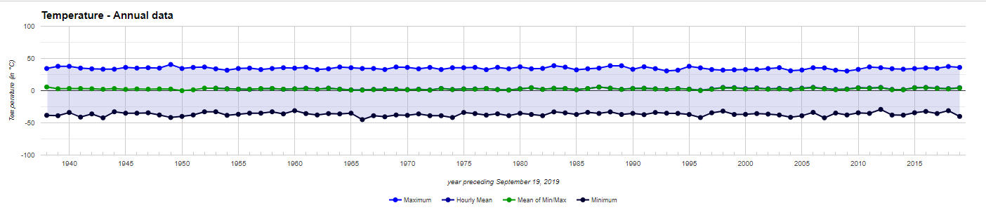
The story, in this case, is that the average daytime high in Winnipeg is in the low- to mid-30s, the average daily low is in the low- to mid-minus-30s (sometimes in the minus 40s), and that's that. Anyone who listens to alarmists and thinks Winnipeg will soon be a Miami of the north is welcome to open a theme park in confident expectation, but please don't complain when the sun-seekers don't show up.
The number of days with temperatures below minus 20 dipped in the 1980s, reaching a minimum in 1987, before climbing back up to an all-time record in 1996: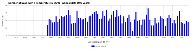
Meanwhile the number of days with temperatures above 30C held up in a promising way up to the 1980s, then went down: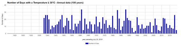
Annual precipitation likewise declines to tell a story of change: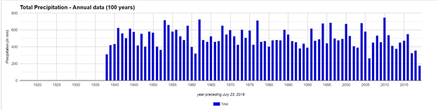
As does average wind speed: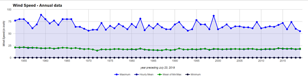
While maximum wind gust is gently drifting down:
If you're hoping to find a climate emergency out there, keep looking.


I used that web-site to look at a number of different locations around Canada. It does appear as if the climate, at least as far as temperatures go, has been pretty stable over the last 25 years. Sadly, the trend would appear to indicate no warming, and thankfully, no cooling.