The City of Toronto has embraced the climate emergency movement with great gusto, even floating the idea of new property taxes to combat… something or other. Unfortunately they're 70 years too late. According to weatherstats.ca, Toronto average daytime highs hit their all time peak of 38.3 C back in 1948. Since then? See for yourself: 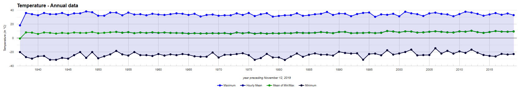
If you look closely you can see somewhat warmer mean temperatures starting about 20 years ago, though the minimums have recently fallen back down to their earlier norms.
Total precipitation has not trended up or down since 1942: 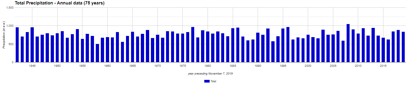
To be sure, beginning in the 1980s less of it has fallen as snow. Well, except in 2008 which set the all-time snowfall record for Toronto: 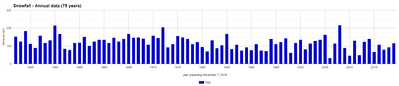
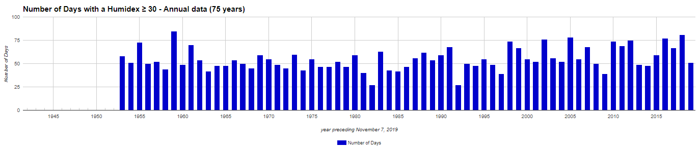
Notwithstanding Catherine McKenna's admonitions earlier in the year that the rising number of heatwaves proved the importance of their climate policy, the number of days in Toronto with a humidex above 30C reached an all-time high way back in 1959:
1959 was also the year Toronto recorded its highest average windspeed: 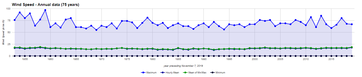
Mind you the maximum gust that year (122 km/h) didn't quite reach the level of 1956 (135 km/h). But both are records not reached since, and the last time wind went above 120 km/h was 1964: 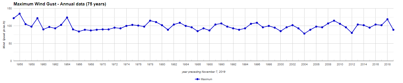
Strange to think they didn't declare a climate emergency back then. Maybe they were afraid of looking foolish.


A minor point: Toronto’s “average daytime high” did not peak at 38.3 degrees C in 1948. Rather, that was its hottest daytime temperature ever recorded. An average high of 38.3 in 1948 would have meant some days were much, much hotter than that....
Surely Toronto has been heating up dangerously in the past few decades. How else do you account for all of the addled brains there?
Afraid of looking foolish? These days they let an autistich kid bring the message. Or is that still foolish?